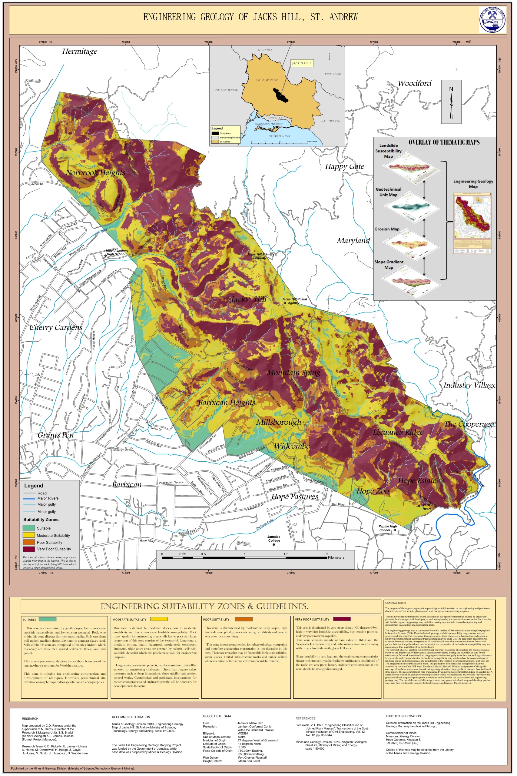
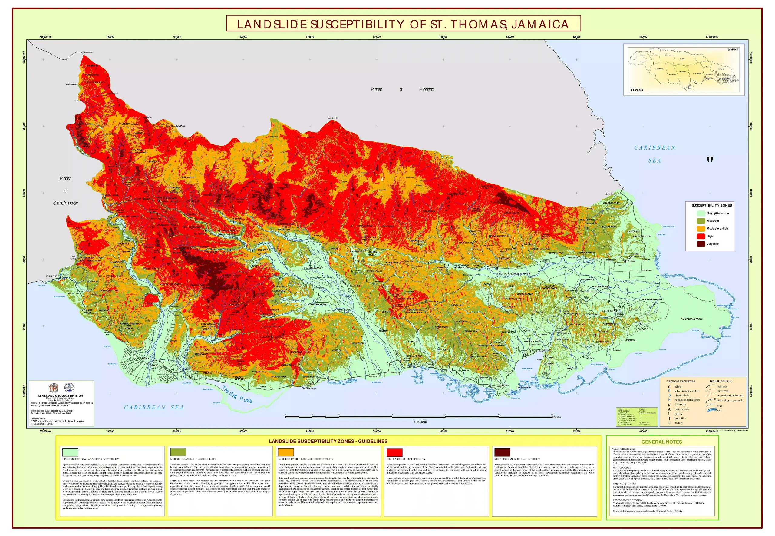
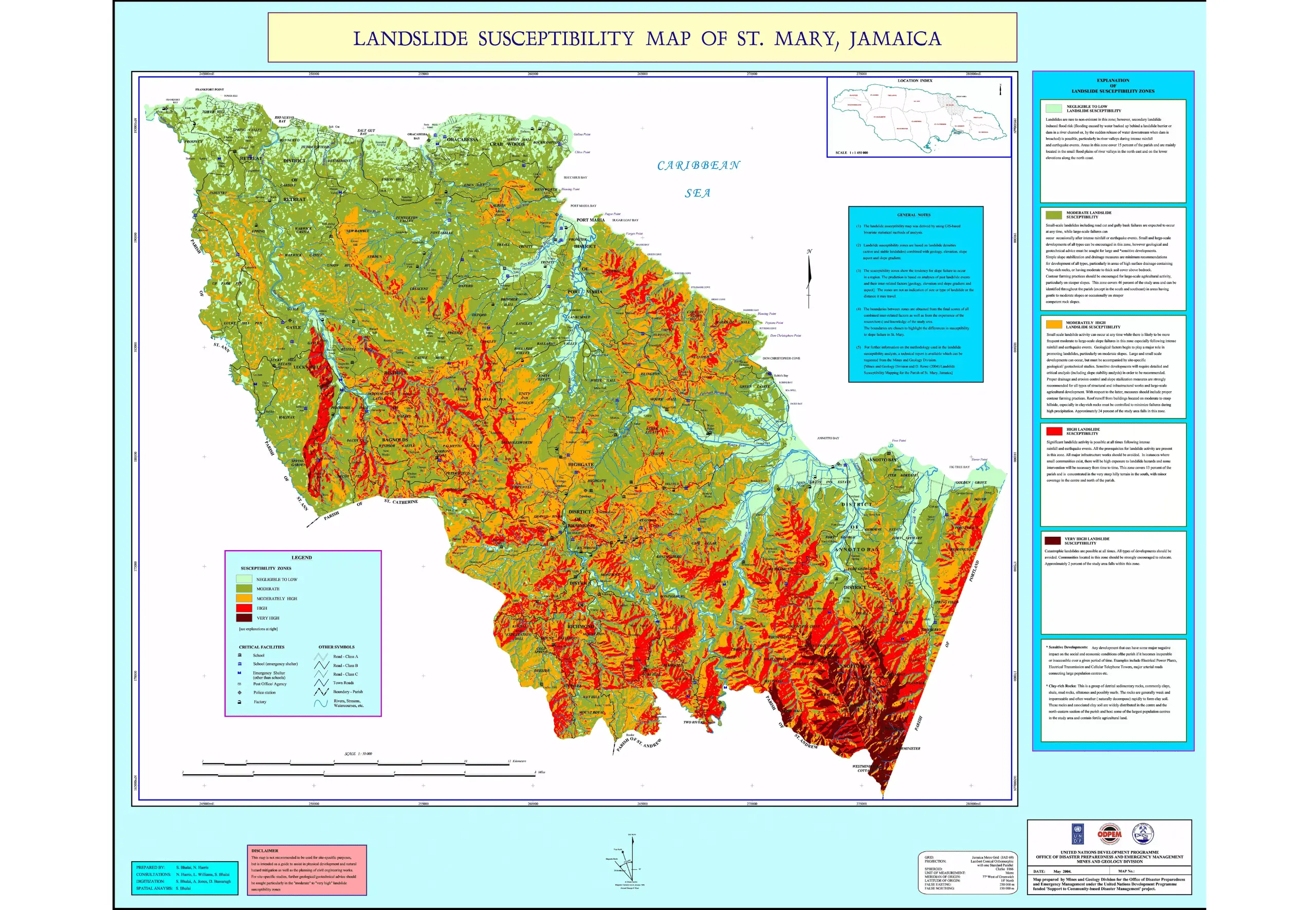
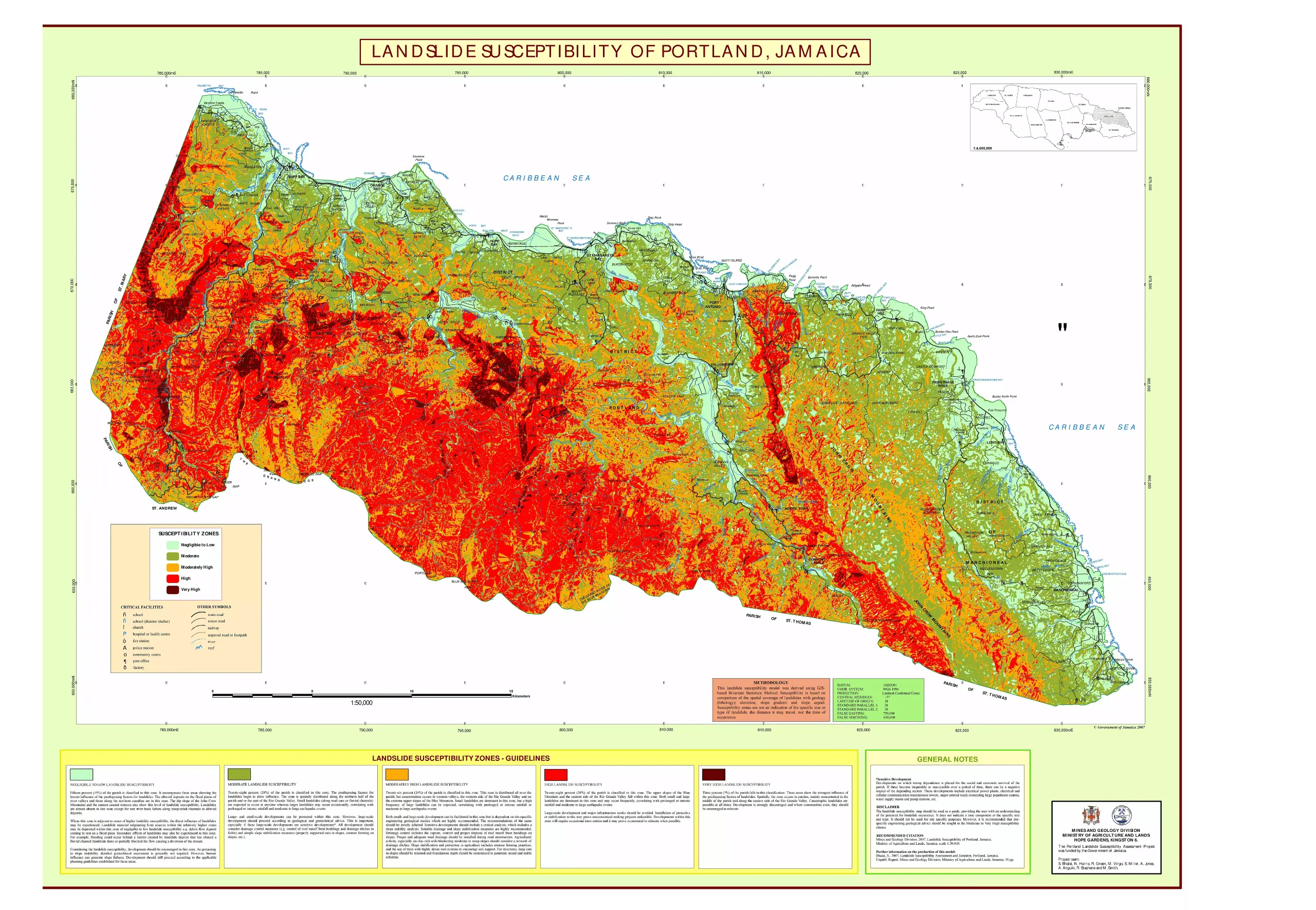
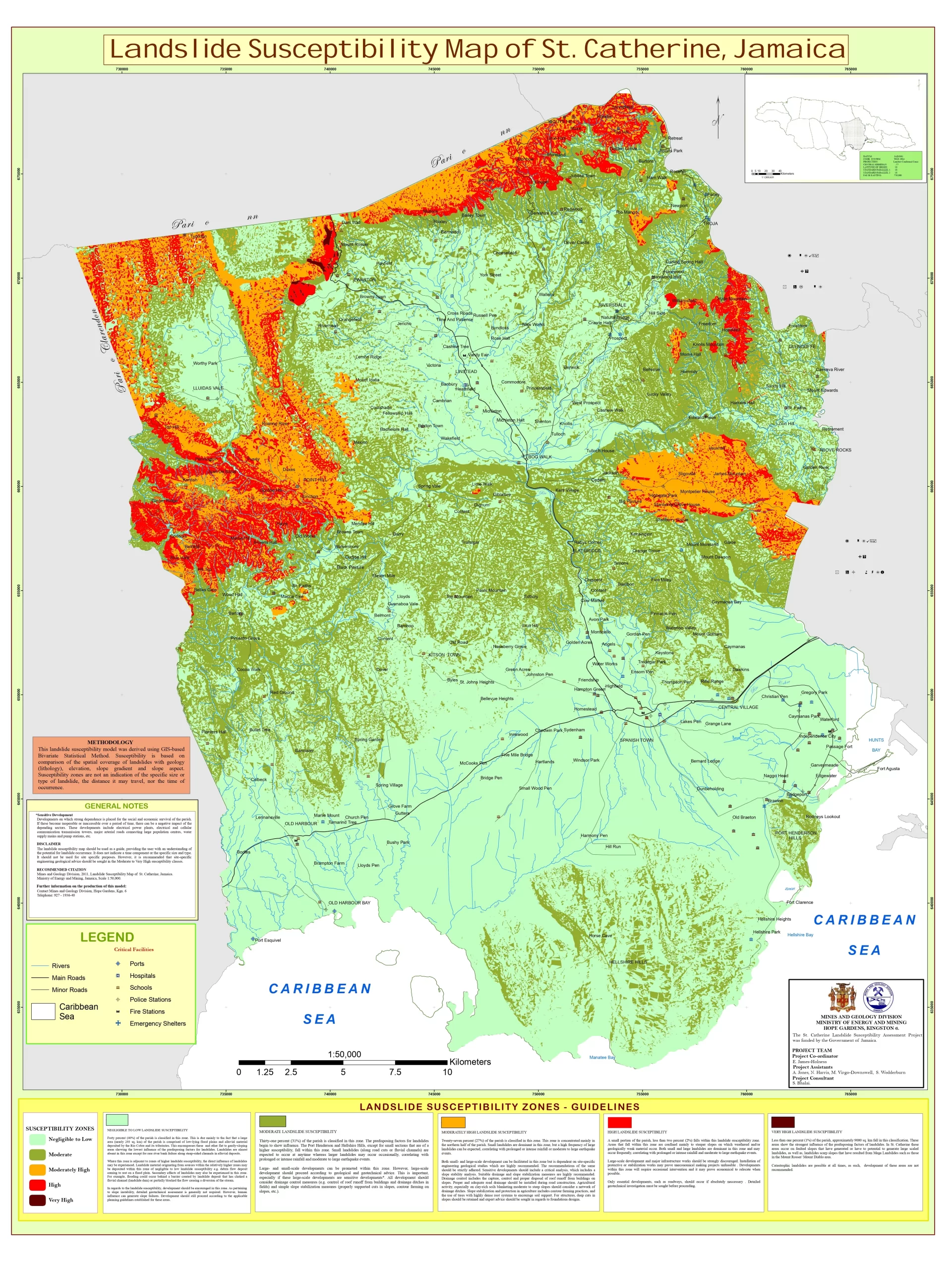
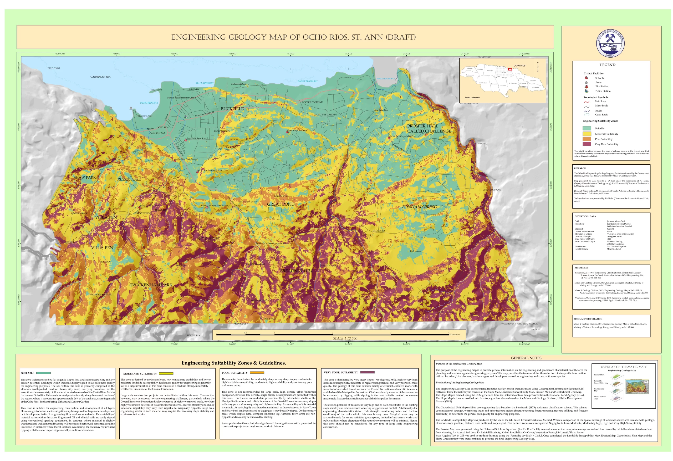
Landslide susceptibility or hazard maps are commonly used to display the spatial distribution of landslide hazard zones in a given area. The maps are intended to be used as a guide to assist technical and professional groups involved in natural hazard mitigation physical planning and development as well as in the planning of civil engineering works.
In addition, the maps can be used by individuals and community groups who have an interest in assessing the susceptibility of their property or community to landslide hazards.
Landslide susceptibility/hazard maps at the scale provided should not be used for site-specific purposes because of the scale at which the data was obtained. However, further advice can be sought from the Mines and Geology Division regarding the information presented on the maps.
Guidelines are included to assist the user to understand the different landslide zones and to provide solutions to problems that may arise in the respective hazard zones. It is the intention of MGD to conduct landslide susceptibility/hazard mapping for other parishes in Jamaica using each parish as a landslide mapping unit. The Division wishes to go even further by preparing landslide vulnerability maps which will provide more meaningful information, particularly in the built environment.
Landslide Susceptability Maps:
Click to view more detailed map
-
St. Thomas
-
St. Mary
-
Portland
-
St.Catherine
-
Ocho-Rios
-
Jacks-Hill